
The 2021 Ahrtal Flood: What Happened, Why It Was So Deadly, and What Changed
Key Takeaways
The Ahrtal flood 2021 was a fast-moving disaster in which extreme rainfall met a narrow, settled valley and an emergency system that struggled to turn warnings into action.
- Record rainfall caused the Ahr River to rise with extraordinary speed.
- Terrain, debris, darkness, and damaged infrastructure magnified the danger.
- Technical warnings did not consistently become clear evacuation instructions.
- Rescue workers and residents accomplished much under exceptionally difficult conditions.
- Recovery has brought new warning tools, rebuilding, and difficult questions about future risk.
1. What happened in the Ahr Valley on 14–15 July 2021
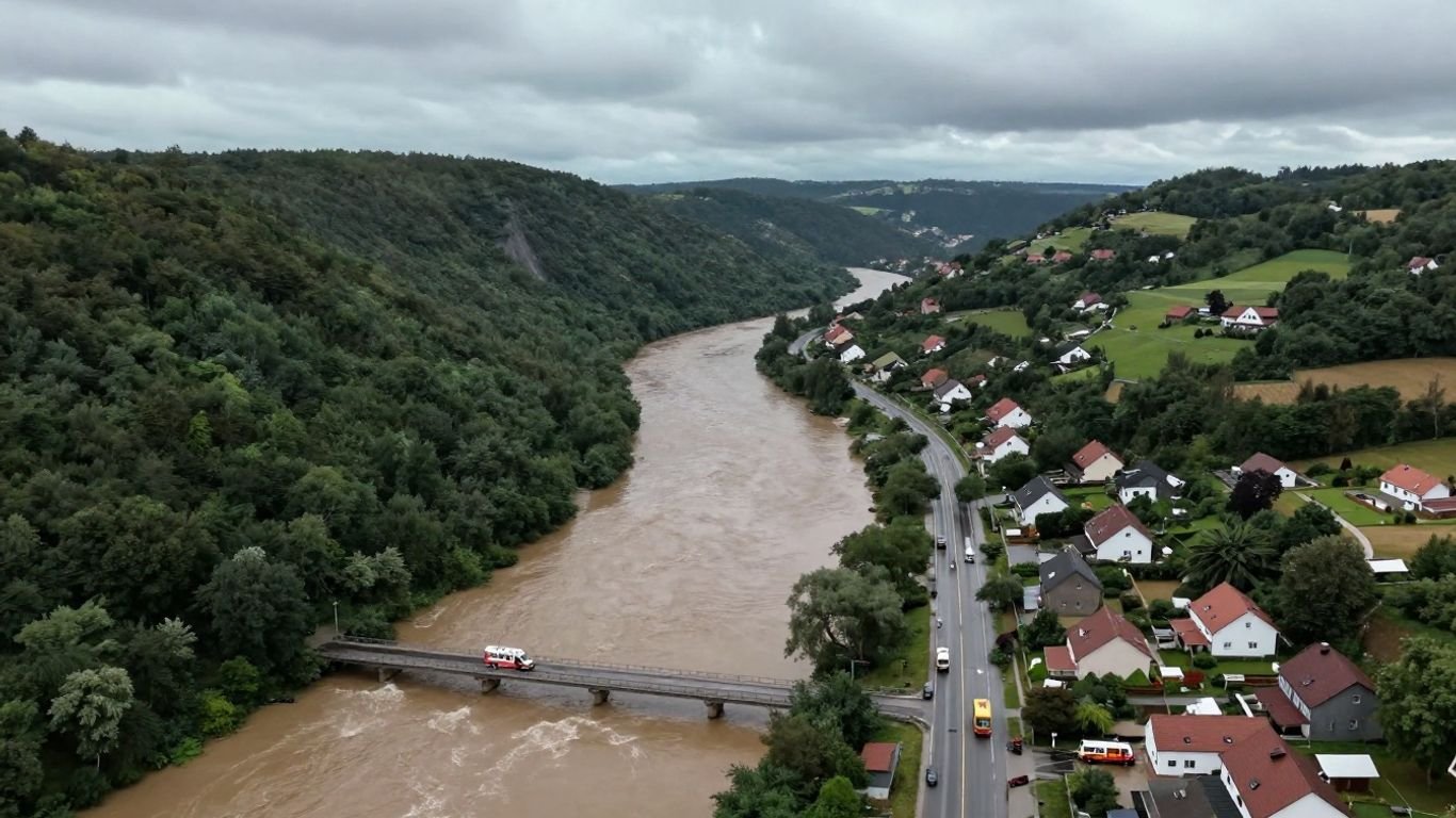
The flood struck western Germany after days of unsettled weather and an exceptionally intense period of rain. The Ahr Valley’s communities were hit during the night of July 14 and into July 15, when many people were at home and visibility was poor. What followed was not simply a larger version of an ordinary river flood; it was a sudden, destructive transformation of the valley.
The weather system that brought record rainfall
A slow-moving low-pressure system drew moist air across western Europe and produced prolonged, heavy rain. In parts of the Ahr catchment, rainfall totals reached levels far beyond what residents and authorities had recently experienced. The wider event affected several European river basins, but the Ahr Valley became one of the disaster’s most tragic centers. A European floods overview places the Ahr event within that broader July catastrophe.
How the Ahr River rose with extraordinary speed
Water collected across steep tributaries and entered the Ahr faster than the river channel could carry it away. The river rose dramatically over a few hours, carrying trees, vehicles, household objects, and fragments of buildings downstream. Familiar reference points disappeared, and people who had watched water levels earlier in the evening found that conditions had changed radically by nightfall.
Towns, bridges, roads, and homes overwhelmed by the flood
The river cut through places including Schuld, Altenahr, Dernau, and Bad Neuenahr-Ahrweiler. Bridges were swept away or badly damaged, roads became impassable, and homes near the river were inundated. Electricity, water, telecommunications, rail links, and other essential services were disrupted at the same time, leaving isolated communities to make decisions with incomplete information.
The scale of deaths, displacement, and property damage
The Ahr Valley suffered roughly 135 deaths, while the wider German disaster killed 196 people. Thousands of residents were displaced, and the damage extended across homes, businesses, vineyards, public buildings, utilities, and transport links. The human toll cannot be reduced to a single number: many survivors lost their homes, livelihoods, records, and sense of security in one night.
2. Why the flood became so deadly
Floodwater becomes most dangerous when natural forces meet human exposure. In the Ahr Valley, settlements, roads, care facilities, and businesses occupied a confined corridor beside a river that could change character within minutes. The event also revealed how quickly a modern community can lose the infrastructure on which evacuation and rescue depend.
The narrow valley and steep terrain that concentrated floodwater
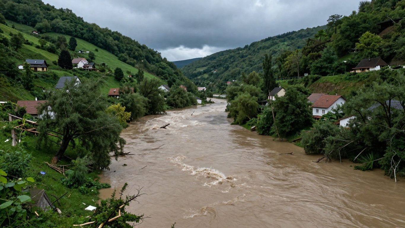
The Ahr runs through a winding valley bordered by steep slopes. Tributaries descend rapidly from surrounding hills, concentrating runoff into the main channel and leaving relatively little room for water to spread safely. Buildings and transport routes close to the river were therefore exposed to both rising water and the force of moving debris.
Saturated ground, debris, and the failure of protective infrastructure
Earlier rain had left soils wet, so additional rainfall ran off quickly rather than soaking in. Trees, cars, propane tanks, furniture, and parts of structures became floating or battering debris. Walls, bridges, culverts, and embankments that might withstand ordinary high water were damaged, blocked, or overtopped. The water did not arrive alone; it carried a destructive mass through the valley.
Why nighttime flooding left residents with little time to escape
Darkness removed visual cues and made it harder to judge depth, current, and safe routes. Many people learned the seriousness of the flood only when water entered their homes, roads disappeared, or neighbors began calling for help. Minutes mattered enormously, particularly for anyone who needed assistance, had no vehicle, or lived below an upper floor.
The dangers faced by older residents and people in care facilities
Older adults and people receiving care may face mobility limits, medical needs, or strong ties to homes they have occupied for decades. In care settings, evacuation requires staff, transport, medication, records, and a safe destination. Research on older residents’ recovery has also drawn attention to lasting anxiety, depression, trauma symptoms, and the importance of reliable information after the water recedes.
Separating the natural hazard from preventable human failures
The rainfall and terrain were natural hazards, but the consequences were shaped by choices about settlement, warning chains, preparedness, and command. It is possible to acknowledge an extraordinary storm without treating every death as unavoidable. That distinction is central to any honest assessment of the Ahrtal flood 2021: nature created the threat, while institutions and individuals influenced how much protection people received.
3. Warnings, forecasting, and the breakdown of public communication
The warning question remains at the heart of the disaster. Meteorological and hydrological information existed, but information is not the same as a warning that a resident understands and acts upon. The path from a national forecast to a frightened household involved several agencies, different thresholds, local judgment, and communication channels that did not always work together.
What meteorologists and hydrologists knew before the disaster
Forecasts indicated exceptional rainfall and the possibility of severe flooding. Hydrological models and river-level data showed that the situation could become dangerous, yet predicting the exact timing, depth, debris impact, and location of the worst damage was difficult. A warning system must therefore prepare for uncertainty without allowing uncertainty to become an excuse for inaction.
How warnings moved from national agencies to local authorities
National agencies issued weather and flood information, while state and local authorities were responsible for interpreting conditions and taking protective measures. That division can work when roles are clear and communication is rapid. During the crisis, however, different levels of government had different pictures of the threat, and responsibility for turning alerts into evacuation orders was not always obvious.
The gap between technical alerts and clear instructions for residents
A technical alert may identify rainfall probabilities, river stages, or warning categories, but a family needs practical direction. Should people leave now? Which route is safe? Where should they go, and what should they take? The failure was not simply that data were absent; it was that data did not consistently become plain, urgent, geographically specific instructions.
Sirens, mobile alerts, radio, and the limits of fragmented systems
Sirens were absent, damaged, unheard, or insufficient in some places. Mobile coverage and power supplies were vulnerable, while radio and door-to-door communication depended on functioning equipment and people who could move through dangerous streets. The later expansion of phone-based alerts reflects a basic lesson: no single channel should be expected to reach everyone.
Whether people were told plainly enough to evacuate
Many residents have said that they did not receive a direct warning that conveyed the scale of the danger. Others did hear warnings but did not understand how quickly the river could rise. Clear communication must overcome both institutional hesitation and ordinary human disbelief, especially in places where severe flooding feels rare even though historical floods are part of local memory.
4. The emergency response and its disputed failures
The response included firefighters, police officers, military personnel, municipal workers, medical teams, neighbors, and volunteers. Many worked for hours in darkness, often without reliable roads, power, or communications. At the same time, the scale of the emergency exposed gaps in planning and coordination that individual bravery could not permanently solve.
How firefighters, police, military personnel, and volunteers responded
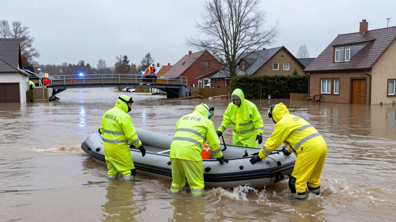
Responders rescued people from roofs, moved residents through floodwater, treated the injured, searched damaged buildings, and brought supplies into isolated areas. Volunteers arrived with boats, pumps, generators, food, clothing, and practical skills. Their efforts were indispensable, but they also showed how much the response depended on improvisation when formal systems were overwhelmed.
Evacuations, rescues, and the challenge of destroyed infrastructure
Evacuation is difficult when bridges are gone, roads are underwater, and landmarks have disappeared. Rescue teams had to decide where vehicles could safely travel and which buildings required immediate attention. In some places, residents moved themselves and their neighbors to higher ground before official assistance arrived, while others could not leave without specialized support.
Communication failures among municipalities and emergency agencies
The destruction of telephone networks and radio infrastructure made coordination harder precisely when coordination mattered most. Municipalities and emergency agencies could not always share a common operating picture. Reports moved unevenly, local knowledge was scattered, and responders sometimes entered areas without a reliable sense of what had already been searched or what remained inaccessible.
Questions about preparedness, command responsibility, and accountability
Investigations and public debate have focused on who received which warnings, when decisions were made, and whether emergency plans matched the known risks. Accountability should not be confused with blaming every person who faced an impossible choice. It means identifying responsibilities in advance and examining whether leaders, agencies, and systems performed them adequately.
Why local knowledge and individual initiative mattered so much
Residents knew which lanes connected neighborhoods, which buildings housed vulnerable people, and where water had previously collected. That knowledge helped guide rescues when maps and communications were unreliable. A practical emergency plan should preserve that local experience rather than assuming that a distant authority can understand every street during a fast-moving crisis. The idea of one clear coordinator is relevant beyond business travel: emergencies also require clear ownership of information and decisions.
5. The political and institutional fallout
The flood became a national political issue because it raised questions about leadership, federalism, and the capacity of a wealthy country to protect its citizens. Anger grew as survivors described missed warnings, delayed assistance, and confusing public messages. The debate was not only about one storm; it was about whether government institutions had learned enough from earlier floods.
Public anger over warnings, leadership, and delayed action
Public frustration came from the contrast between alarming forecasts and the limited instructions many people recalled receiving. Images of devastation intensified scrutiny of officials who had been warned that flooding could be severe. Political leaders faced questions about visibility, judgment, and whether they treated the event as a remote possibility instead of an immediate threat.
Investigations into the roles of state and local officials
Authorities examined decisions made at multiple levels, including warning dissemination, evacuation planning, and emergency command. Such inquiries are complicated because responsibility is distributed across Germany’s federal structure. Still, complexity should not make responsibility disappear; a system must be designed so that the public can know who has authority to act.
The debate over climate change, land use, and government competence
Climate change does not explain every local decision, but warmer air can hold more moisture and increase the potential for intense rainfall. The flood therefore renewed debate about emissions, river-valley development, protective infrastructure, and whether rebuilding should reproduce old vulnerabilities. Responsible policy has to address both the changing hazard and the exposure created by where and how people build.
Compensation, aid distribution, and concerns about bureaucratic delays
Emergency grants and reconstruction funds helped many households and businesses, but applying for aid could be slow and demanding. Survivors often had to document losses while still living with damaged homes and uncertain utilities. Guidance on documenting storm damage, although written for a different emergency, reflects a practical principle that applies here: records, photographs, inventories, and prompt reporting can matter when assistance is assessed.
What the disaster revealed about Germany’s federal emergency structure
Germany’s federal system can bring local knowledge and national resources together, but it can also create unclear handoffs. The Ahr flood exposed the cost of fragmented authority when time is short. Better coordination requires shared standards, interoperable communications, regular exercises, and clear rules for who may order protective action when the evidence is alarming but incomplete.
6. What changed after the Ahrtal flood
Recovery has involved more than replacing damaged buildings. Authorities and communities have worked on warning technology, evacuation procedures, roads, bridges, utilities, flood defenses, and mental-health support. Progress has been real but uneven, and reconstruction itself has forced difficult decisions about speed, safety, heritage, and the future shape of the valley.
Expanded flood forecasting and the Cell Broadcast warning system
Germany introduced the Cell Broadcast system so compatible mobile phones can receive location-based emergency alerts without requiring an app subscription. It supplements sirens, radio, official websites, and direct local communication rather than replacing them. Better forecasting also increasingly considers likely impacts, because the question is not only how high a river may rise but what that rise will do to people and infrastructure.
New evacuation planning, sirens, and local emergency exercises
Communities have reviewed evacuation routes, assembly points, shelter arrangements, and procedures for people who need assistance. Sirens have received renewed attention, as have exercises that test plans under realistic conditions. A plan on paper is not enough if residents do not know its signals or responders have never practiced working around blocked roads and failed communications.
Rebuilding roads, bridges, utilities, and flood defenses
Reconstruction has required extensive work on transport links, water and power systems, public buildings, bridges, retaining structures, and river corridors. Each project presents a choice between restoring what existed and building something more resilient. The rebuilding process described in Ahr Valley reconstruction illustrates how infrastructure decisions have become part of the region’s wider attempt to reduce future danger.
The push to restore the valley while reducing future risk
Residents understandably want homes, businesses, schools, vineyards, and tourism to return. Yet restoration cannot mean pretending that the old level of exposure has vanished. Setbacks from the river, stronger structures, open space for floodwater, protected critical facilities, and maintained access routes can reduce harm, although each measure has social and economic costs.
Mental-health support and the long recovery for survivors
The psychological aftermath continues long after streets are cleared and roofs are repaired. Grief, displacement, financial pressure, disrupted routines, and fear of rain can affect survivors for years. Support must remain available beyond the first emergency phase, with particular care for older people, children, caregivers, and those who lost both property and community networks. Mixed Nature’s practical, inclusive perspective is useful as a reminder that recovery planning should account for people’s lived needs, not only physical assets.
7. The unresolved lessons for future disasters
The Ahrtal flood is now studied far beyond Germany because its central problems are widely shared. Forecasts can improve, but institutions still need to act; warning devices can multiply, but people still need to recognize danger; and reconstruction can be ambitious, but communities still must decide where risk is acceptable. The hard lesson is that resilience is built before the rain begins.
Why no warning system can replace personal preparedness
Alerts can fail because of power loss, poor reception, damaged equipment, language barriers, hearing impairment, or simple confusion. Households should know where to go, how to contact one another, and what to do if roads and phones stop working. Useful preparation includes keeping essential medication, water, lighting, identification, and charging equipment ready, without assuming that a rescue will arrive immediately.
How residents can understand flood maps and evacuation routes
Flood maps are not predictions of the exact next event, but they show where water may reach and which areas are exposed. Residents should identify nearby high ground, alternative routes, bridges that may become unusable, and facilities that need special assistance. A short family discussion before an emergency is more useful than trying to interpret a map while water is entering the street.
The trade-off between rebuilding in place and relocating from risk zones
Rebuilding in place can preserve homes, community ties, jobs, and local identity. Relocation may reduce exposure but can also break social networks and impose costs that families cannot bear equally. Decisions should use transparent risk information and give affected residents a meaningful voice, rather than treating either restoration or removal as an automatic answer.
Holding institutions accountable without ignoring individual responsibility
Officials must answer for warnings, planning, communication, and resource allocation. Individuals also have responsibilities: paying attention to alerts, helping vulnerable neighbors when safe, and avoiding dangerous roads or floodwater. Accountability works best when it improves systems instead of becoming a ritual of accusation that leaves the underlying weaknesses untouched. Mixed Nature’s emphasis on practical education offers a useful general model: people need clear information they can apply, not vague reassurance.
What the Ahrtal flood teaches communities across Europe and the United States
Communities in Europe and the United States face different laws, landscapes, and emergency structures, but the pattern is familiar: intense rainfall, exposed development, vulnerable infrastructure, and uneven communication can combine quickly. The Ahr Valley fatality study underscores why impact forecasting and attention to infrastructure belong beside weather prediction. Mixed Nature’s inclusive approach also points to a broader standard for preparedness: plans should account for varied ages, abilities, households, languages, and resources. Crisis adaptation guidance for small organizations, such as business crisis resilience, offers another transferable lesson—practice, flexibility, and clear decisions matter before a crisis becomes chaotic. International workers may face separate administrative risks, as explained in global payroll compliance, while outdoor spaces and materials require their own planning, including durable outdoor furniture; these are not flood solutions, but they show why preparedness must be tailored to the actual risk rather than treated as a slogan.
A useful way to translate the lessons into household action is to separate preparation into a few concrete decisions:
- Identify the nearest safe high ground and two routes to reach it.
- Sign up for official alerts and learn local siren signals.
- Prepare medication, water, lighting, documents, and phone power.
- Check on neighbors who may need help, without entering unsafe water.
- Decide when to leave rather than waiting for conditions to become impossible.
These steps do not eliminate danger, and they cannot excuse institutional failures. They do, however, reduce the chance that a household will be forced to improvise every decision in darkness. Personal preparation and public accountability belong together.
Conclusion
The 2021 Ahr Valley flood was a warning about more than extreme rainfall. It showed how terrain, settlement, infrastructure, communication, and political responsibility interact when minutes matter, and it left Germany with the difficult task of rebuilding without repeating old assumptions. The most durable response is a combination of honest accountability, better public systems, and practical preparation that treats every resident as someone who deserves clear information and a realistic chance to get safe.
Frequently Asked Questions
What was the Ahrtal flood 2021?
It was a catastrophic flood in Germany’s Ahr Valley during the night of July 14–15, 2021, after exceptionally heavy rainfall caused the Ahr River and its tributaries to rise rapidly.
How many people died in the Ahr Valley flood?
About 135 people died in the Ahr Valley, while the wider flooding across Germany caused 196 deaths.
Why did the water rise so quickly?
Heavy rain fell across a steep catchment whose soils were already wet. Runoff moved quickly into the narrow river valley, where debris and limited space intensified the flood.
Were residents warned about the danger?
Weather and flood warnings were issued, but they did not consistently become clear, urgent, local instructions telling residents when and where to evacuate.
What made nighttime flooding especially dangerous?
Darkness reduced visibility, concealed the depth and speed of the water, and made it harder to identify safe routes. Many people had little time to gather essentials or assist others.
What warning changes followed the disaster?
Germany expanded flood forecasting, renewed attention to sirens and evacuation exercises, and introduced Cell Broadcast alerts for compatible mobile phones.
What should households do before a flood?
Households should learn local flood risks, identify evacuation routes and high ground, monitor official alerts, prepare essential supplies, and make plans for children, older adults, people with disabilities, and pets.